-Testour is located at a hummock over the sea with a height between 70 and 90 meters over the ocean.
-It is surrounded by hills from all sides : hindi hill - skhira hill - shitana hill - kshtilou hill - kharoub hill - jabbas hill
-Fertile rivers could be found between the city and it's hills : gnima - kate wadi - sbnyar
-Majrda river crosses the city along with the two creeks of Silyana and Khaled and smaller rivers like jabana river - awina river - halouf river
-Testour has a strategic location on main road 5 which links the capital with the algerian borders in sakiyet sidi youssef crossing mornagiya, borj amri, majaz al beb, slougiya then tabarsak, krib and el Kef
-The highway reduced the time to less than an hour between capital and Testour
ـ The distance between Testour and... :
- The capital 75Km
- Beja 51Km
- El Kef 91Km
- Mjaz el Beb 20Km
- Tbarsak 24Km
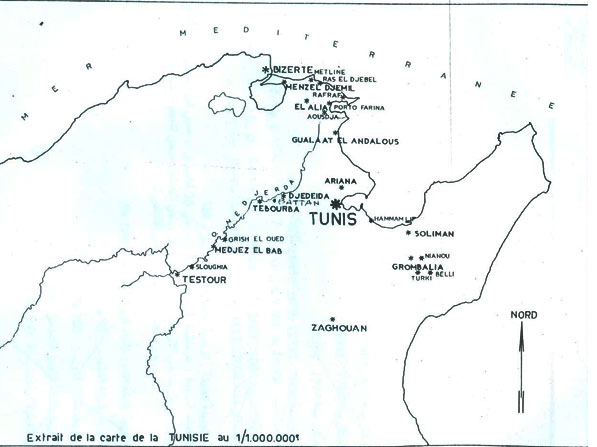
Testour is surrounded by a lot of villages : slougiya - wadi zarka- skhira - awlad ayar - awlad slama - ain younes - ain nafta - wadi el jadra - zaldou - mzougha
 |
 |
|
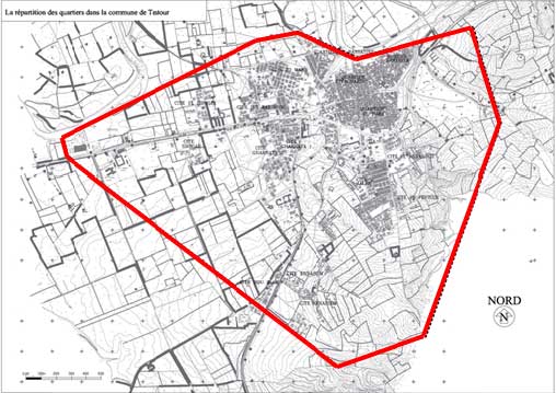
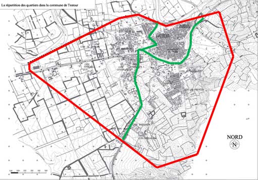
| The territory of municipal area | The seperation of land area regarding districts and areas |